EG Mobile

Info
Map Position    Cluster      Map Kind:
show map
RouteWaypointRoute // Waypoint

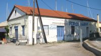
Perlia

After the bridge of the isthmus' canal, is the settlement where the refugees from Minor Asia first lived. On the left, westwards, is the Perlia area (with touristic infrastructure) on the road towards Neorio.

Rating

EG Editors:
Υοur Rating:
Users' Rating:
Popularity: 0

Attributes

Altitude (in meters) : 9

 Less
 More

Similar: Routes

Poros -View from Agii Anargiri
Municipal Region
Poros (355)
(Municipal Region)
ATTIKI
Poros - Path to Agii Anargiri
Path
ATTIKI, POROS
Poros - Path to Vigla's Top
Off Road
ATTIKI, POROS
Argosaronikos- Poros-Ο Κipos
Other Route
To the Clock Tower
(Other Route)
ATTIKI, POROS
Argosaronikos- Poros-Ferry to Methana
Aqueous
Ferry Boat
(Aqueous)
ATTIKI, POROS
Poros - Kavos Bay
Waypoint
Kavos Vassili
(Waypoint)
ATTIKI, POROS
Trizina - Before Vlachaika
Waypoint
ATTIKI, POROS
Poros - Camps
Waypoint
Camp site
(Waypoint)
ATTIKI, POROS
Trizina - Xaravgi Old Estate
Waypoint
Haravgi Estate
(Waypoint)
ATTIKI, POROS
Argosaronikos- Poros-Seawage treatment
Waypoint
ATTIKI, POROS
Galatas - Shipyard
Waypoint
Poros Marine
(Waypoint)
ATTIKI, POROS
Argosaronikos- Poros- Argolida perfecture boundaries
Waypoint
ATTIKI, POROS

DISTANCES


My Trip
0.3859 19.53MB