How to Get There
The "easiest" way to get to the Castle of of Zangoli is by walking through the Koutoupou Stream that starts from Dipotama (shortly after the Cave of Agia Paraskevi), 5 kilometers from Kastanitsa on the way to Agios Andreas. (From Dipotama one can also ascend to Kastanitsa from the old cobblestone path.)
We will not descend to the stream at Dipotama; we can continue in our vehicle for about one more kilometer, until we see a small flat area with a bench on the left side of the road. We can park here, then descend carefully to the stream bed.
The route is very beautiful and relatively easy (if we remember to walk in the riverbed). There are two or three narrow spots with rocks and some water, but there is a way through at the side. As we approach the intersection point with the Loulougas Stream, the stream bed narrows, and rocks rise up high on both sides. A thousand meters from where we started our hike in the stream (after about 25 minutes), we will hear the water of the Loulougas Gorge coming from the left.
If we turn left, we will head toward the famous Loulougas Gorge (one of the most beautiful in the Peloponnese), with its waterfalls and lakes, and toward Sitaina. Continuing straight ahead, we will see a red arrow that says "Elenis" and leads us (after a steep climb) to a cave in the cliff. According to tradition, a young newlywed (Eleni) fell from a cliff below the cave at the time of the German occupation, and was killed.
We will turn right toward Tripotama. After about 230 meters, we will reach the point on our left where we can begin our ascent to the small Castle of Zangoli and the little church of the Virgin Mary. The castle is not visible from below (that is, from the stream). However, there is a plastic sign hanging from a branch to mark the spot. If we miss it in spite of that and continue straight ahead, 30 to 50 meters farther down there is an uneven point that we cannot pass through without special equipment, so we will be forced to go back.
The initial ascent to the castle begins sharply and requires care. The route is quite long (about one thousand meters), and as we climb we increase our altitude by about 200 meters. After the beginning of the ascent from the stream, the well-known red marks will show us the path we need to follow.
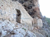
The arduous climb rewards us in the end with the impressive appearance of the castle built into the rock, inaccessible and deserted (although it has now turned into a corral). On our left is the little white church of the Virgin Mary of Zangoli. To the right of the castle, a path leads to another lovely little church. This beautiful wild landscape provides a totally unique experience that is well worth the effort. The total journey time from Dipotama to the Castle of Zangoli is about 75 to 90 minutes (without stops).
If we continue in the Koutoupou Stream even after it joins the Loulougas Stream, then shortly after the Castle of Zangoli we will encounter the Mazia Stream (at Tripotama). The Vrasiatis River (or Charadros River) begins here; it extends to Agios Andreas Beach.


